The walking route starts at junction 70 on the Markt. You walk towards junction 80. You soon leave the built-up area. To the right of the route is the winding Uffelsebeek. The name Grathem means “house on a ridge”. Grat means ridge and this refers to a sandy height in the landscape. By Him is meant hem, which means house. After a rainy period, the paths at this “sandy height” can still be quite wet. So wear sturdy shoes.
Op Kapittelsbos and Grathemer Molen
After a 10-minute hike you reach the Op Kapittelsbos farm. The name of the former mixed farm refers to the time when the farm and its surroundings fell under the administration (chapter) of Thorn. The farm, which has been owned by members of the same family for generations, has been transformed by the current owners into a recreational and cultural farm with landscaped garden.
You walk along the banks of the Uffelsebeek towards the Grathemer mill. Chewing marks and a real castle show that a large family of beavers are enjoying themselves here.
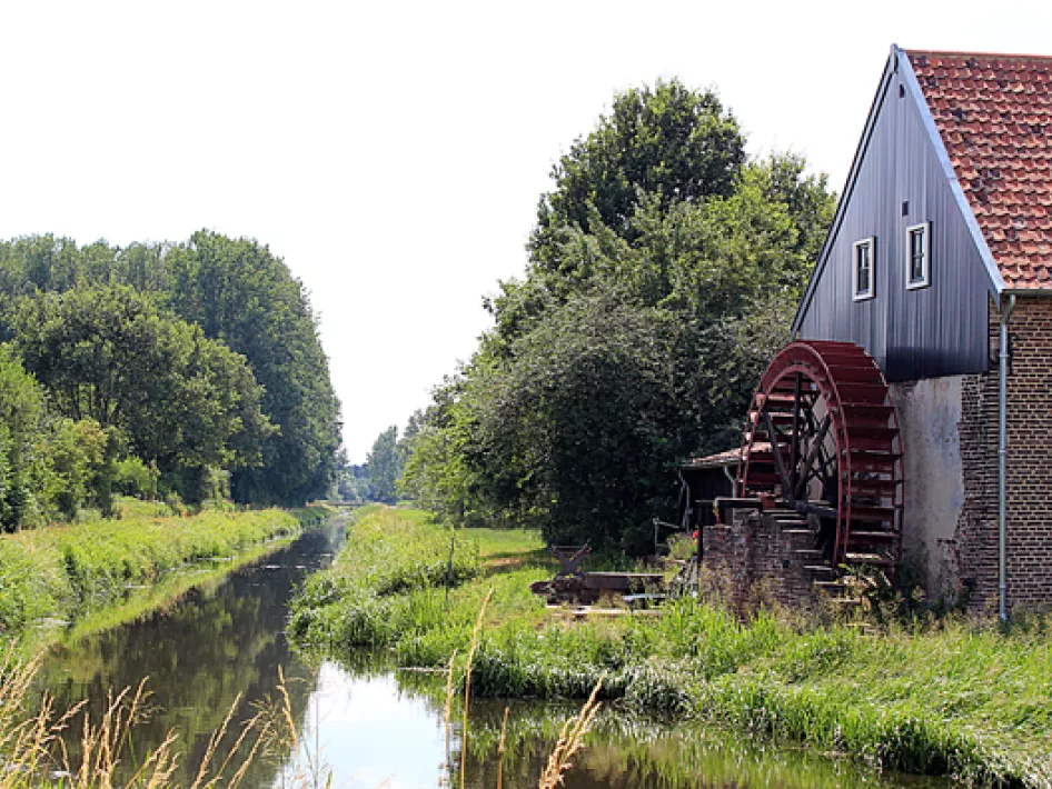
The stream water flows wildly past the wheel of the Grathemer Mill.
There was a water mill on the Uffelsebeek as early as the 14th century. The rights to this mill belonged to the Stift van Thorn. After the mill was owned by noble families for several centuries, it was sold in 1872 to the then tenant. This gave the mill its current appearance in 1874 through a thorough restoration. In 1915, a steel turbine was installed for propulsion. This turbine also generated power for part of Grathem. The mill is still fully operational today. When the mill is operating, it can be visited freely. Think carefully about asking the miller. The text on a chalkboard teaches us that 1 euro must be paid for answering stupid questions.
Groot (old) Buggenum and Prof. Helmut Hentrich
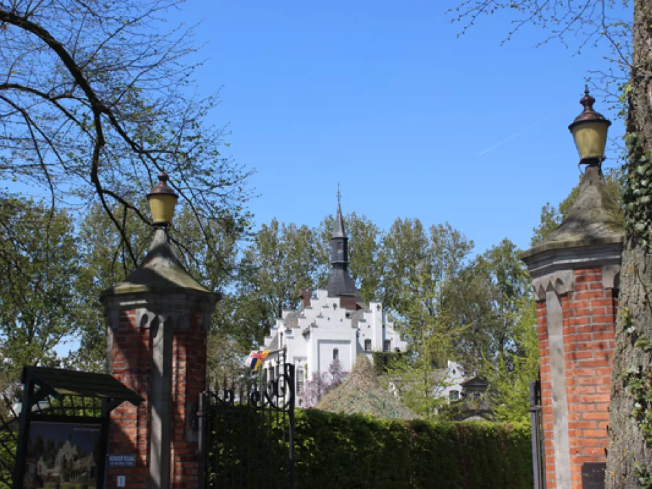
You leave the mill and cross Brugstraat. After a few minutes you will find Groot Buggenum Castle on your right. Or is it “Oud Buggenum” as an information sign along the route indicates. The first mention of a castle on this site dates back to 1329. Until 1880 the castle was a noble property and was destroyed several times by fire or war.
The merchant Willem Verbruggen, who came from Grathem, had the old house demolished and erected the current building in 1886. The castle fell into serious disrepair, partly due to acts of war during the Second World War. In 1971, the German architect Professor Helmut Hentrich bought the ruin and rebuilt it in its current form. “Es soll leben” said the professor. And it does. The castle can be visited by appointment and if you have something to celebrate, this is a beautiful, romantic location.
You continue walking. You may see an inland vessel sliding through the landscape right in front of you. You are approaching the Wessem-Nederweert Canal. You go parallel to the canal for a moment and then turn to return to the bank of the stream. Once again traces of an intensive beaver life. Information signs along the stream tell about the rich flora and fauna in and near the stream. About the Prof. Hentrichpad you cross a meadow and go via the Brugstraat towards the starting point of the route.


